 |
|
|
Earystane Wind Turbine Transport Manx Utilities had chosen a potential site for a wind farm at Earystane in the South of the Island. The survey was to accurately measure 18 roundabouts, corners and chicanes between Douglas sea terminal and Earystane to determine the maximum size of turbine blades which can be brought through those locations. Prior to the survey a plan existed to undertake a beach landing in Castletown, with the associated disturbance to nature. 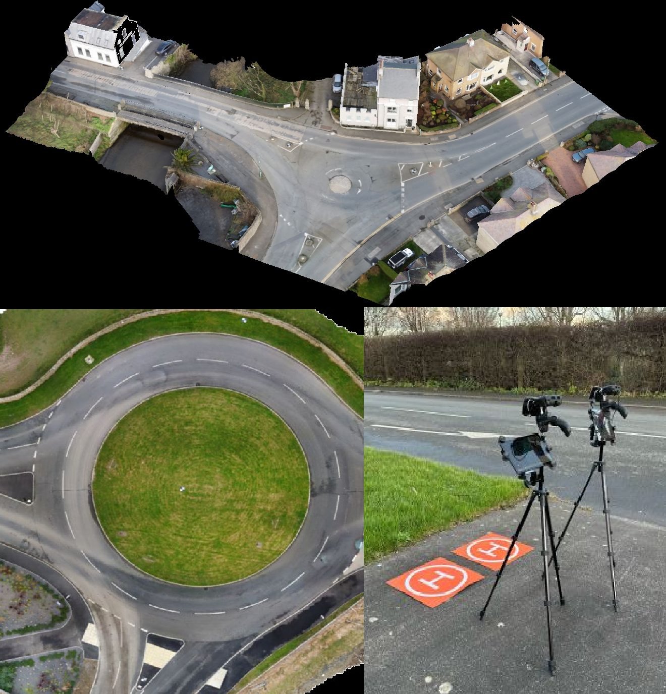
Techincal Aspects The sites were challenging, perhaps the most challenging sites on the Isle of Man: the Sea Terminal and Quarter bridge, two of the busiest locations on the island, quarterbridge also was surrounded by 25m tall trees, and could not be closed for data collection. A further 9 locations within the airport zone with restricted flying. Weather was also challenging, wind and rain was the story of most of this winter, the wettest on record, finishing at The Sloc, with snow on the ground, and a biting wind. 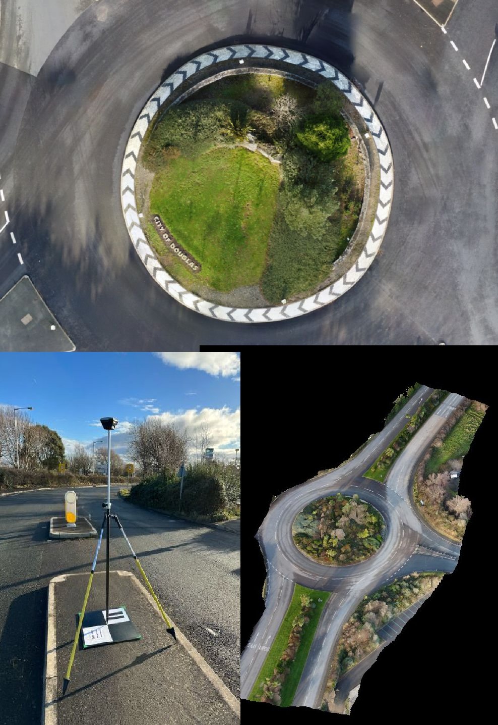
Expertise gained over the last decade went into this project, 3 months of flights with a perfect safety record. Data collection with an accuracy of better than 2 cm, some sites as long as half a km, verified with check control points. Dronesurvey have perfected precise large area data collection within dense population areas, with the upmost accuracy using ground control points, GNSS fixed base and roving receivers, the end result: 3d model, cloud point and a GeoTIFF for each location. Our flights required automated flights, multiple drones, terrain following, we are proud of the quality of the data collected, despite all these challenges. 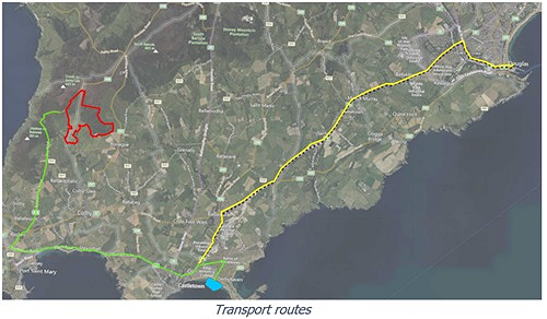
Data was delivered in the form of a topographical GeoTIFF and a 3d cloud point model. The client commented on the quality of data we achieved. Main Index |
|
Call 07624 278693 | Email steven.elkins@dronesurvey.im |
|
| © 2026 Illustrate Ltd t/a Drone Survey. Celebrating 20 years of business, Company number 116227C, VAT GB002521343. |